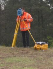
Topography

Tuhinga o mua

Mai i te putanga o Geoinformatics mo te marama o Poutu-te-rangi, anei he arotake poto mo te ahua umanga o nga kamupene nunui kei roto i te maheni. Ko te nuinga o nga panui he pai te mahi.


geoinformatics

Leica

E whakapono ana ahau ki te whakahoutanga

Trimble

Hono ki tetahi ao o nga mea e taea ana

geoinformatics
geoinformatics

Sokkia

Ko te whakawhitinga i te rereke

Tuhinga o mua

ProMark 500 + ProFlex 500
Te whakawhitinga teitei

geoinformatics
geoinformatics

Topcon

GLS - 100

Sokkia

Te waimarie ki te neke

geoinformatics
geoinformatics

ESRI, Arcpad

Kohia me te tuhi i nga raraunga o te mara me te maatau me te tika

Ko Golgi Alvarez

Kaituhi, kairangahau, tohunga mo nga Tauira Whakahaere Whenua. Kua uru atu ia ki te kaupapa whakaaro me te whakatinanatanga o nga tauira penei: National System of Property Administration SINAP in Honduras, Model of Management of Joint Municipalities in Honduras, Integrated Model of Cadastre Management - Registry in Nicaragua, System of Administration of the Territory SAT in Colombia . Ko te Etita o te blog matauranga Geofumadas mai i te 2007 me te kaihanga o te AulaGEO Academy e nui atu i te 100 nga akoranga mo nga kaupapa GIS - CAD - BIM - Digital Twins.

Tefito pā

Waiho i te tākupu

Ka kore e whakaputaina tō wāhitau īmēra. Kua tohua ngā āpure e hiahiatia ana ki *

Hoki ki te pihi papa